

A mandatory evacuation remains in effect for visitors on Hatteras Island as a powerful coastal storm threatens North Carolina’s Outer Banks with flooding, strong winds and dangerous ocean conditions.
Dare County officials are urging visitors who have not yet left the island to depart as soon as possible. Forecasts from the National Weather Service indicate that conditions could deteriorate through Saturday, Oct. 17, and Sunday, Oct. 18, potentially making parts of N.C. Highway 12 impassable for several days.
Ocean overwash, when waves push seawater across beaches and onto coastal roads, could disrupt access to the island and leave people stranded. Officials warn that those who remain may face limited access to emergency assistance if conditions worsen.
The approaching storm is expected to bring several days of hazardous weather, with impacts potentially continuing into early next week.
Coastal flood warning issued for the Outer Banks
The National Weather Service has upgraded a Coastal Flood Watch to a Coastal Flood Warning as the threat of significant flooding increases.
Moderate flooding is expected along exposed oceanfront areas of Hatteras Island, while major flooding remains possible in some locations. Water levels could rise 2 to 4 feet above ground level in vulnerable areas, accompanied by large breaking waves, beach erosion and repeated ocean overwash.
The most significant oceanside flooding is forecast around high tides on Sunday, Oct. 18, and Monday, Oct. 19. However, strong winds and elevated water levels could produce additional flooding episodes throughout the following days.
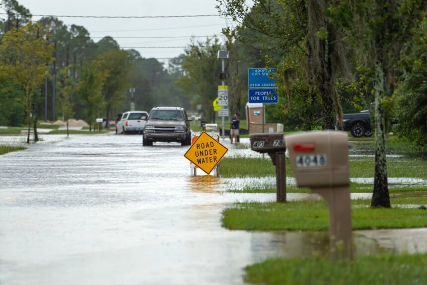
Sections of N.C. Highway 12 are particularly vulnerable to ocean overwash and may experience extended closures. Motorists are advised not to drive through flooded roads.
Visitors with upcoming reservations on Hatteras Island should avoid traveling to the area and contact their lodging providers directly for information about bookings.
Soundside flooding could affect low lying areas
Flooding is also possible along the soundside of Hatteras Island, particularly in low lying communities in the southern portion of the island.
Water levels could reach 1 to 3 feet above ground level in affected locations. Flooding could begin Saturday evening, with the greatest impacts expected Sunday and Monday.
The extent and duration of flooding will depend on the storm‘s track, strength and wind direction.
Residents in vulnerable areas are encouraged to monitor forecasts and consider moving vehicles to higher ground before water levels rise.
Strong winds could cause power outages
A Wind Advisory is in effect for the Outer Banks and mainland Dare County, with north to northeast wind gusts expected to reach 45 to 55 mph along the coast.
The strongest winds are forecast from Saturday night through Sunday night, with hazardous conditions potentially continuing through Monday, Oct. 19.
These winds could bring down trees, scatter debris and cause isolated power outages. Driving may also become difficult, especially for high profile vehicles.
Officials are encouraging residents to prepare for several days of hazardous weather and possible disruptions to electricity and transportation.
Dangerous surf and marine conditions expected
The storm is also expected to produce hazardous conditions along Dare County beaches, including large breaking waves, powerful rip currents and significant beach erosion.
Residents and visitors are advised to stay out of the ocean and maintain a safe distance from the shoreline.
Marine conditions are expected to worsen as gale force winds affect coastal waters, sounds and rivers. Storm force winds are forecast in some offshore areas.
Seas could reach 12 to 15 feet off the northern Outer Banks, with waves potentially reaching 15 to 20 feet in offshore waters near Cape Hatteras. These conditions could endanger vessels and create hazardous conditions for mariners through the middle of next week.
Ferry service disruptions are also expected to begin Saturday evening and could continue into at least part of the following week.
Emergency updates and closures
Dare County Emergency Management is monitoring the storm alongside the National Weather Service, the North Carolina Department of Transportation and other local and state agencies.
Visitors and residents can call the Dare County Emergency Management Information Line at 252-475-5655 for information about the evacuation.
Residents can receive emergency text alerts by texting DareEmergencyAlerts to 77295.
Meanwhile, the National Park Service has closed campgrounds, off road vehicle ramps and visitor facilities at Cape Hatteras National Seashore, along with Fort Raleigh National Historic Site and Wright Brothers National Memorial. Reopening will begin after conditions improve and officials complete post-storm assessments.
Officials have also warned that several privately owned oceanfront homes in Rodanthe remain structurally compromised and could collapse. Exposed septic systems, unstable structures, strong winds and high surf create additional hazards. Visitors should avoid affected areas and stay away from debris if a collapse occurs.